
Destinations
Overlanding Arunachal Pradesh: Mechuka and Tawang by 4x4
Permits, terrain and season for India's wildest 4x4 frontier - the road to Tawang and the valley of Mechuka.
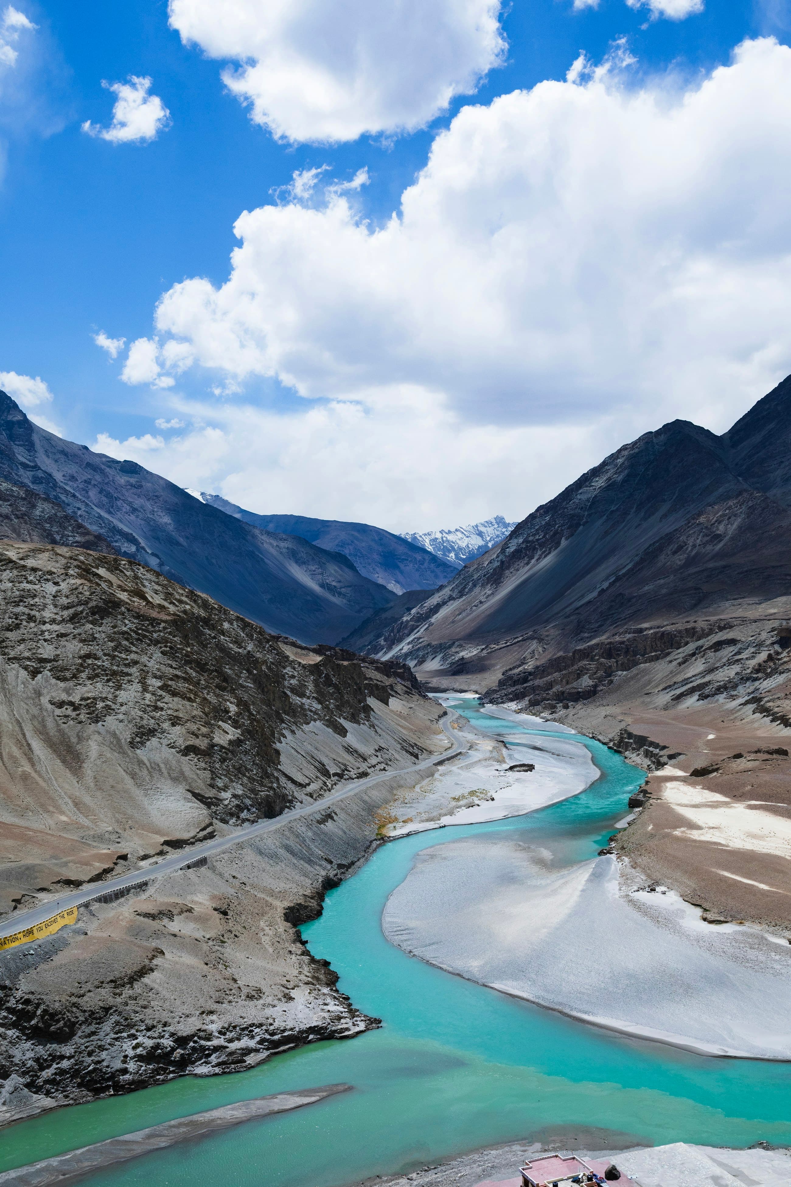
Overlanding Arunachal Pradesh means driving India's least-travelled 4x4 frontier - misty valleys, broken mountain roads, and border villages like Mechuka and Tawang that feel a world away from Ladakh's desert. The two essentials are the Inner Line Permit, which every Indian needs to enter Arunachal (foreigners need a Protected Area Permit), and timing your trip to dodge the ferocious monsoon, which can wash away entire stretches of road from June to September. The terrain here is the opposite of the high desert: dense forest, relentless rain-fed mud, river crossings and landslide-prone slopes rather than thin air and altitude. We have run expeditions to both valleys, and Arunachal rewards the patient, self-sufficient overlander more richly than almost anywhere else in India - but it punishes anyone who underestimates the rain and the distances.
What permits do you need for Arunachal Pradesh?
Every Indian citizen needs an Inner Line Permit (ILP) to enter Arunachal Pradesh, easily obtained online or at entry points like Itanagar, and you must carry it in original with photocopies because there are checkposts throughout. Foreign nationals need a Protected Area Permit (PAP) and generally must travel in a group with a registered operator. Sensitive border areas near Mechuka and beyond Tawang may need additional clearances, so check the current requirements before you go. The permit system is the single biggest piece of paperwork separating a smooth Arunachal trip from one stopped at a checkpost, so sort it well in advance and keep multiple copies in the vehicle and on your phone.
- Indians: Inner Line Permit (ILP), obtainable online or at Itanagar and other entry points.
- Foreigners: Protected Area Permit (PAP), usually requiring a registered operator and a group.
- Carry originals plus several photocopies; checkposts are frequent throughout the state.
- Border-sensitive zones near Mechuka and beyond Tawang may need extra permissions - verify first.
A practical tip on the paperwork: carry more copies than you think you need, and keep a clear photo of each permit and each vehicle document on your phone in case the originals get soaked - which, in Arunachal, they will try to. Checkposts will want to see and sometimes retain a copy, so a stack of ten photocopies is not excessive on a longer trip. Sort the ILP online before you leave home where you can, rather than relying on getting it at the entry point on a public holiday or a slow connection. The permit is cheap and the process is straightforward; the only way it ruins a trip is if you leave it to the last minute and arrive at a checkpost without one.
What is the road to Tawang actually like?
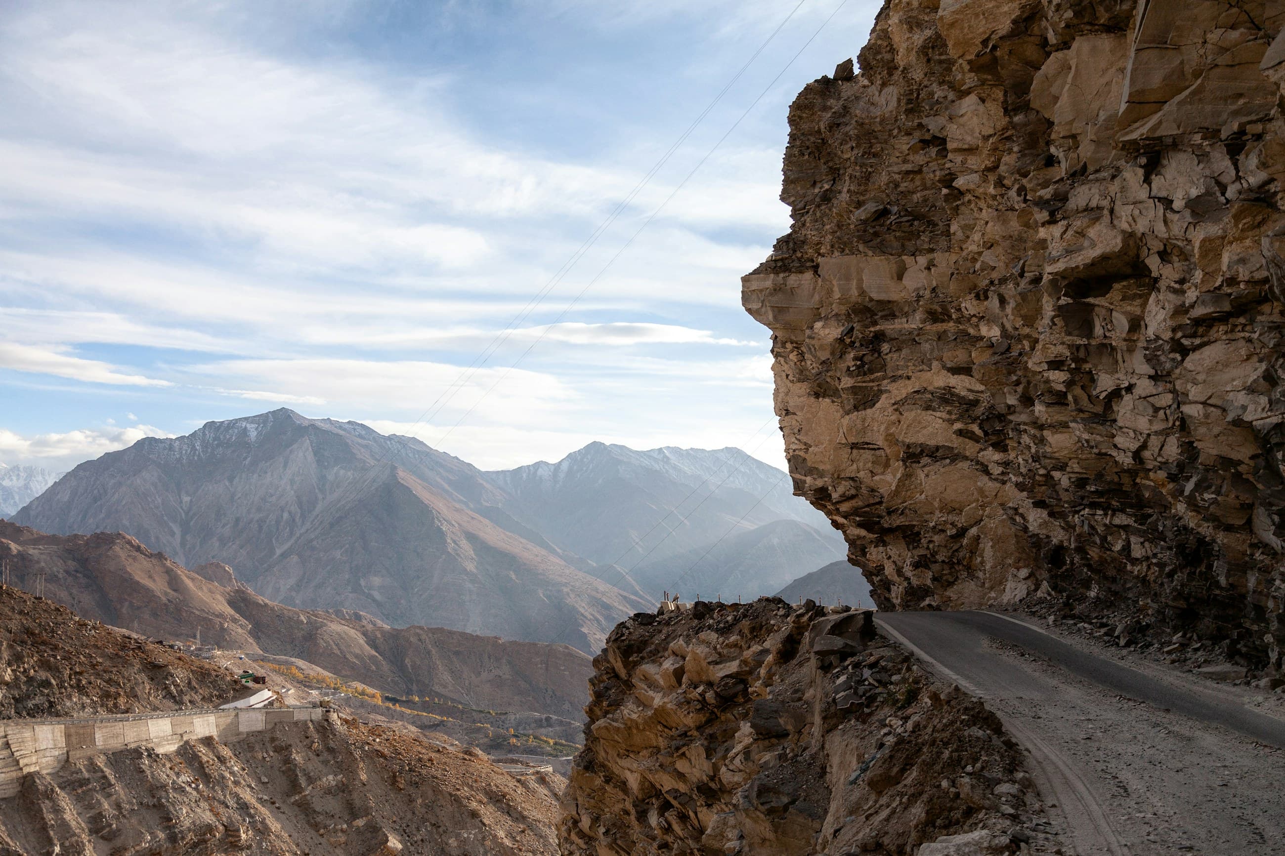
The classic route to Tawang climbs from the Assam plains at Tezpur up through Bomdila and over Sela Pass at about 4,170 m before descending to Tawang at around 3,050 m. It is roughly 320 km from Tezpur and takes a full, hard day or better split over two. Sela Pass is the crux - high, often fogbound, snowbound in winter, and the road around it has long been a mix of tarmac and broken, muddy construction zones (though the new Sela Tunnel has improved year-round access). Below the pass you wind through cloud forest with sheer drops and frequent small landslides. It is not extreme rock-crawling, but it is relentless, slow, slippery mountain driving that demands total concentration and a vehicle that brakes and steers perfectly.
Split that 320 km the way we do and it becomes far more enjoyable. Tezpur to Bomdila, around 160 km, is a good first day - you gain altitude steadily, the road is mostly reasonable, and Bomdila at roughly 2,400 m is a sensible place to break and let your body adjust. Bomdila to Tawang the next day takes you over Sela and into the high frontier with energy to spare and daylight in hand. The Sela Tunnel has taken a lot of the year-round uncertainty out of the pass itself, but the approaches and the long descent to Tawang are still slow, wet and landslide-prone, and average speeds drop well below what the map suggests. Drive the daylight, never push tired into the dark on these drops, and treat every blind, dripping corner as if something has come down across it - because sooner or later, something has.
What about the road to Mechuka?
Mechuka, a remote valley near the border at about 1,800 m, is reached via Aalo (Along) on roads that are wilder and rougher than the Tawang route. Expect long sections of broken surface, river crossings, and mud that turns treacherous in any rain - this is where low-range, recovery boards and a winch earn their keep. The valley itself, when you finally arrive, is a wide green bowl with a river running through it, monasteries on the hills, and a frontier stillness that makes the hard drive worth it. The distances feel longer than the kilometres suggest because the average speed on these roads can drop to 20 km/h or less. Fuel and supplies thin out dramatically the closer you get, so the run to Mechuka is one to plan with real care and full jerry cans.
Do the maths on that 20 km/h and you understand why Mechuka humbles people. A stretch that looks like a two-hour hop on the map can be a full day's grinding drive when the surface is broken, a river crossing needs walking first, and a fresh slip has narrowed the road to a single nervous lane. Aalo is your last real resupply of fuel, food and anything mechanical, so you fill every tank and jerry can there and stock several days of food buffer before you commit to the final legs. Treat every river crossing with the full discipline - walk it on foot first, read the depth and the bottom, pick your line, and never, ever cross a stream that is rising with rain. The reward at the end is a green frontier valley most Indians will never see. The price is genuine self-reliance for the whole run in and out.
When is the best season to overland Arunachal?
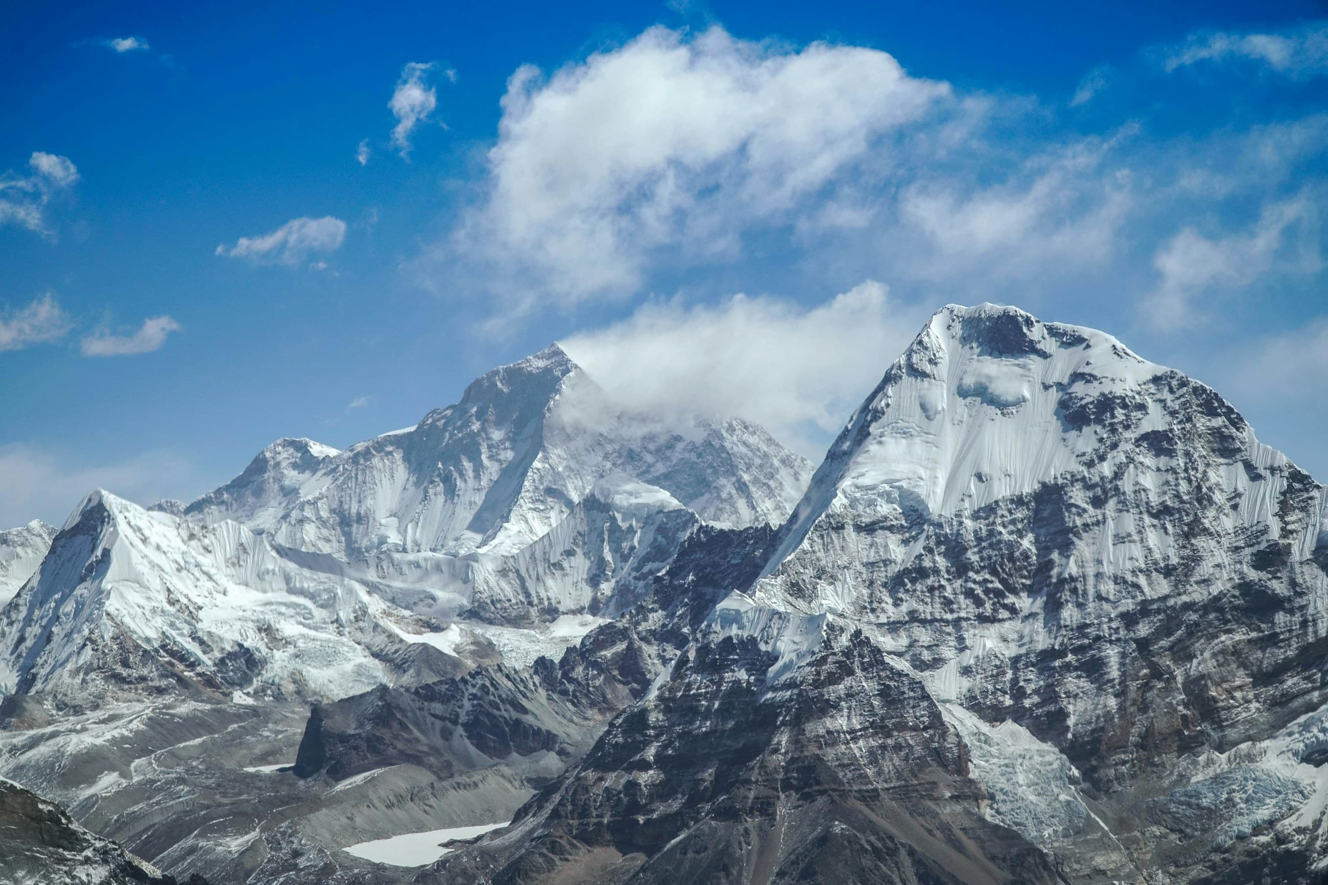
October to April is the window, with October to November and March to April being the sweet spots - clear skies, drier roads and open passes. Avoid the monsoon from roughly June to September at all costs: Arunachal gets enormous rainfall, roads wash out, landslides close routes for days, and river crossings become impassable or deadly. Winter (December to February) is doable in the valleys but Sela Pass and the high routes can be snowbound, so factor that in for Tawang. The shoulder months give you the best balance of open roads and reasonable weather. Whatever the season, build in buffer days, because a single landslide can add a day or two to any Arunachal itinerary without warning.
- Best months: October to November and March to April - clear, drier, passes open.
- Avoid June to September: heavy monsoon, washed-out roads, landslides, dangerous river crossings.
- Winter: valleys accessible but Sela Pass and high routes may be snowbound.
- Always build buffer days; a single landslide can cost you a day or more anywhere in the state.
How should you equip the vehicle and yourself?
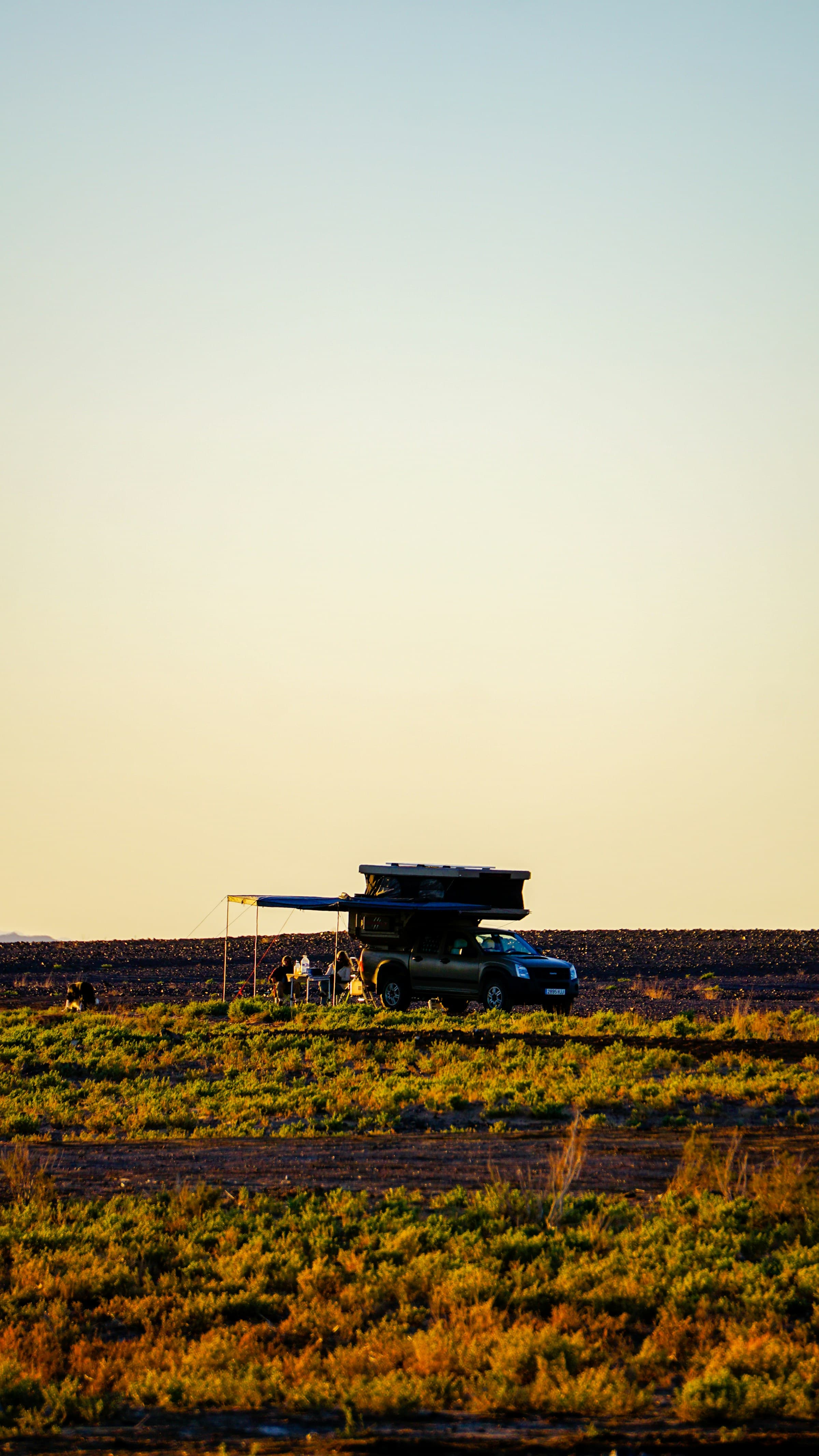
Arunachal is mud and water country, so the kit list differs from Ladakh. You want low-range 4x4, mud-capable tyres, recovery boards, a snatch rope, rated shackles and ideally a winch, because self-recovery from a forest mudhole with no help for 50 km is a real scenario. A SaberLight 270 awning is genuinely useful here, not a luxury - you will spend evenings cooking in steady rain, and a covered space transforms camp life. Waterproof everything, carry a tarp, and treat every river crossing with respect: walk it first, check the depth and bottom, and never cross a rising monsoon stream. Fuel is the other constant worry - pumps are sparse in the interior, so fill at every town (Tezpur, Bomdila, Aalo) and carry jerry cans for the final remote legs.
Ladakh tests you with thin air and Arunachal tests you with rain and distance. Out here you carry your own fuel, you cross your own rivers, and you wait out your own landslides. That self-reliance is the whole point.
How self-sufficient do you need to be?
Very. Beyond the main towns, mobile signal vanishes, fuel is scarce, mechanics are rare, and a serious breakdown means a long, slow wait or recovery. Carry spare fluids, belts, a good tool kit, a tyre plug kit and at least one full-size spare. Stay in homestays and small guesthouses in the villages, which is both the warm, welcoming Arunachali way and the most reliable shelter when rain closes in. Treat all water, carry a few days of food buffer, and tell people your route, because help is genuinely far away. The reward for all this self-reliance is roads and valleys that see a tiny fraction of the traffic Ladakh now gets - some of the last truly wild overlanding left in India.
- Recovery: low-range, mud tyres, boards, snatch rope, shackles, ideally a winch.
- Wet-weather: SaberLight 270 awning, tarp, fully waterproofed gear for daily rain.
- Fuel: fill at Tezpur, Bomdila and Aalo, carry jerry cans for the remote final legs.
- Spares and food: fluids, belts, tools, plug kit, full-size spare, several days of food buffer.
Frequently Asked Questions
Do Indians need a permit for Arunachal Pradesh?
Yes. Every Indian citizen needs an Inner Line Permit to enter Arunachal Pradesh, available online or at entry points such as Itanagar. Foreigners need a Protected Area Permit, usually travelling in a group with a registered operator. Carry originals and photocopies for the frequent checkposts, and keep phone photos as a soaked-document backup.
When is the best time to drive to Tawang and Mechuka?
October to November and March to April are best, with clear skies and drier, more reliable roads. Avoid the June to September monsoon, when landslides and washed-out roads are common. Winter is possible in the valleys, but Sela Pass on the Tawang route can be snowbound, so factor that in if Tawang is your goal.
Is a 4x4 necessary for overlanding Arunachal?
For the remote routes to Mechuka and the rougher border roads, a proper low-range 4x4 with recovery gear is strongly recommended because of mud, river crossings and landslide debris. The main Tawang road can be done by a capable high-clearance vehicle in the dry, but conditions change fast with rain, so even there a true 4x4 with recovery kit is the safer choice.
How remote is Mechuka and what should you carry?
Mechuka is very remote, reached via Aalo on rough roads where fuel, signal and mechanics are scarce. Carry extra fuel in jerry cans, a full recovery kit, spare fluids and a few days of food buffer, and stay self-sufficient. Treat every river crossing carefully and never cross a rising stream. Fill up completely at Aalo, your last real resupply, before committing to the final legs.
Put it into practice
Headed this way? We run guided expeditions on these routes - permits, recovery and a mechanic all handled.